Geology 1810s
William Smith’s geological map
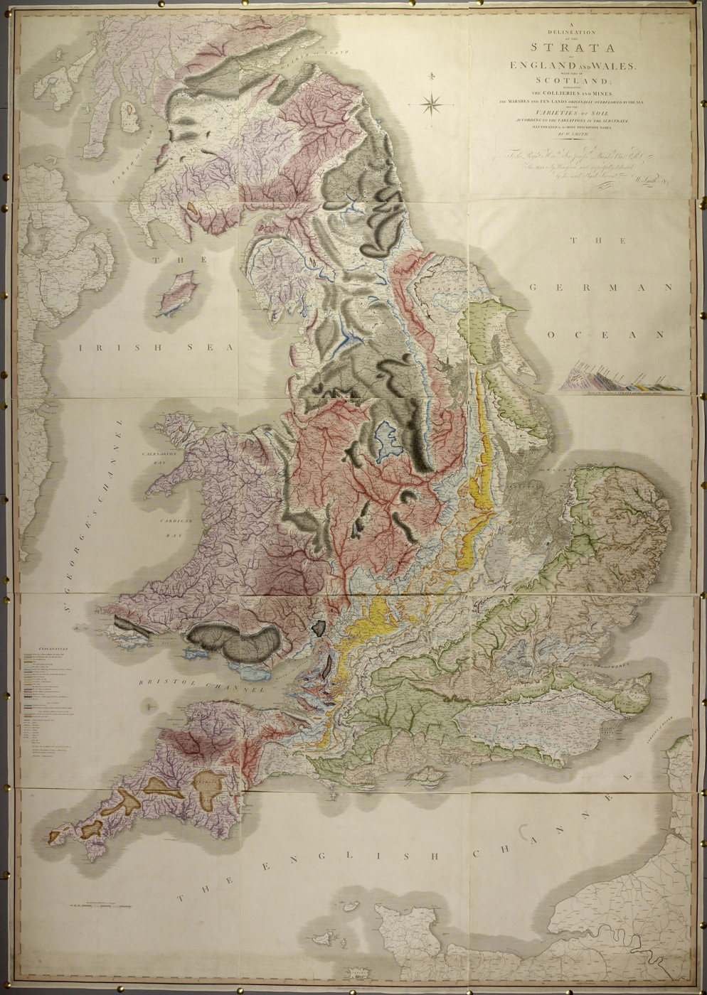
William Smith learned to follow layers of rock while working as a surveyor and canal engineer. Fossils helped him recognise corresponding strata even when the same layers appeared far apart. In 1815 he published a large geological map of England, Wales and part of Scotland, with John Cary as its publisher. Its sweeping colours describe a country beneath familiar county boundaries: bands of chalk, clay, limestone and other formations. Producing it required field observation, money, engraving and hand colouring. Geology became something a reader could trace across an entire region.
About the picture
The coloured bands follow rock formations across political boundaries. Smith used fossils as well as the appearance of rocks to identify strata, connecting scattered exposures into a larger sequence. The map’s key and accompanying section help explain the geological order behind a surface that otherwise looks like a patchwork.
The history behind it
What the source establishes
The map changes what counts as a meaningful boundary. Its bands describe geology rather than administrative control, so they can pass through counties without contradiction. The title also limits the coverage: part of Scotland is not the whole British Isles. An authority-link error supplies a second trap: matching a creator name is insufficient when the linked person’s life and profession do not fit the work. The correct creator is the geologist William Smith and the publication is Cary’s 1815 map. Neither its regional geology nor the accompanying section becomes a complete measurement of subsurface depth at every property.
Dates, places and close alternatives
1815 is the publication date; neither 1769 nor 1839 dates this printed map. England, Wales and part of Scotland is the precise scope printed in the title. The subject is geological strata; the key and section reinforce the meaning of the coloured bands.
Check the catalogue as well as the colours
A useful catalogue check tests whether a linked person’s dates and profession fit the work. The same-name painter does not fit this geological publication. Correcting that identity does not alter the historical map; it prevents the catalogue link from misleading its readers. In the image itself, distinguish geological categories from county outlines and distinguish regional coverage from the much stronger claim of property-level subsurface measurement.
A few things to read next
Books for a longer visit, and a few good places to start online. These are ordinary links, with no affiliate commission.
On the bookshelf
The Map That Changed the World
A readable account of Smith’s work and the difficult life behind the 1815 map.
A History of the World in 12 Maps
For the wider history of maps as arguments about how the world is organised.
The Visual Display of Quantitative Information
A companion for thinking about colour, keys and the communication of evidence.
Read online
William Smith (geologist)
A starting point for names, dates and related subjects. Follow its references when you want to go further.
A Delineation of the Strata of England and Wales, with Part of Scotland
The Society explains the map’s production and publication.
William Smith
Smith’s mapping work in relation to another early geological survey.
Where the pictures come from
The original records and their individual rights statements are below. The pictures have not been generated or altered for the game.
William Smith’s A Delineation of the Strata of England and Wales, with Part of Scotland, 1815.
British Library, Maps.*1180.(20), via Wikimedia Commons · 1815
CC0 dedication on this British Library image; underlying 1815 map is public domain.
History notes and reading lists prepared for Data Barnacle with AI assistance. The source institutions and authors are not sponsors or endorsers. Suggest a correction or another source